Picture 1 of 6


Gallery
Picture 1 of 6


Have one to sell?
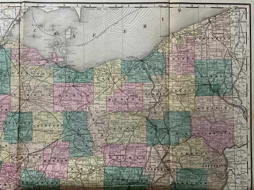
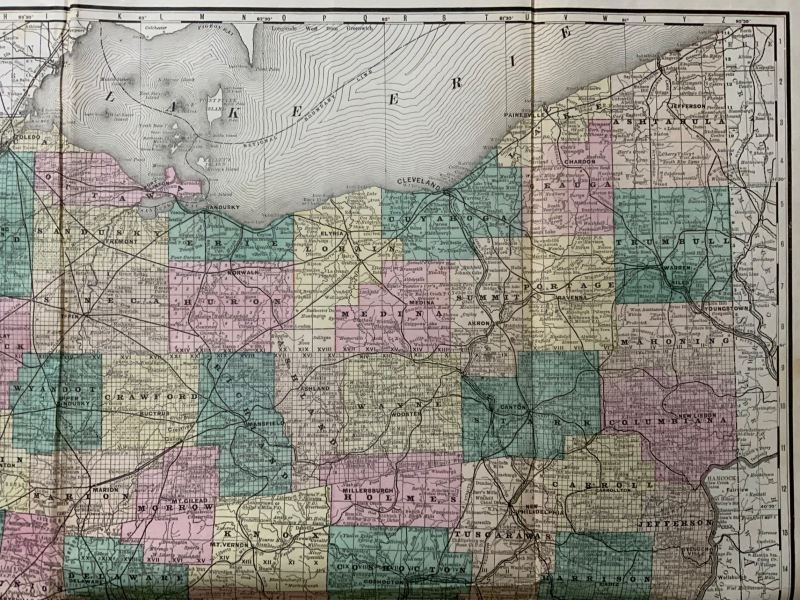
1880 Hardesty, Sectional & Township map of Ohio, very large 24 inch

US $178.84
ApproximatelyRM 752.47
Was US $223.55 (20% off)
Condition:
Oops! Looks like we're having trouble connecting to our server.
Refresh your browser window to try again.
Returns:
30 days return. Buyer pays for return shipping. If you use an eBay shipping label, it will be deducted from your refund amount.
Coverage:
Read item description or contact seller for details. See all detailsSee all details on coverage
(Not eligible for eBay purchase protection programmes)
Seller assumes all responsibility for this listing.
eBay item number:175438620262
Item specifics
- Antique
- Yes
- US State
- Ohio
- Format
- Folding Map
- Printing Technique
- Lithography
- Date Range
- 1800-1899
- Country/Region
- United States of America
- Era
- 1800s
- Year
- 1880
- Type
- County Map
- Original/Reproduction
- Antique Original
- Brand
- Unbranded
- MPN
- Does not apply
Item description from the seller

Seller feedback (50,832)
- Automatische Bewertung von eBay- Feedback left by buyer.Past monthBestellung erfolgreich durchgeführt - mit Sendungsverfolgung und fristgerecht
- Automatische Bewertung von eBay- Feedback left by buyer.Past monthBestellung erfolgreich durchgeführt - mit Sendungsverfolgung und fristgerecht
- Automatische Bewertung von eBay- Feedback left by buyer.Past monthBestellung erfolgreich durchgeführt - mit Sendungsverfolgung und fristgerecht
More to explore :
- Antique North American Maps & Atlases Ohio,
- Ohio County Map Antique North America Atlas Maps,
- Ohio Topographical Map Antique North America Folding Maps,
- Ohio Railroad Map Antique North America Atlas Maps,
- Ohio River Map Antique North America Folding Maps,
- Ohio Antique North America Geological Maps,
- Ohio Contemporary Antique North America County Maps,
- Richmond Ohio Antique North American Maps & Atlases,
- Washington Ohio Antique North American Maps & Atlases,
- Ohio Lithography Antique North America Atlas Maps
Seller feedback (50,832)
- Automatische Bewertung von eBay- Feedback left by buyer.Past monthBestellung erfolgreich durchgeführt - mit Sendungsverfolgung und fristgerecht
- Automatische Bewertung von eBay- Feedback left by buyer.Past monthBestellung erfolgreich durchgeführt - mit Sendungsverfolgung und fristgerecht
- Automatische Bewertung von eBay- Feedback left by buyer.Past monthBestellung erfolgreich durchgeführt - mit Sendungsverfolgung und fristgerecht