Picture 1 of 2

Gallery
Picture 1 of 2


Have one to sell?
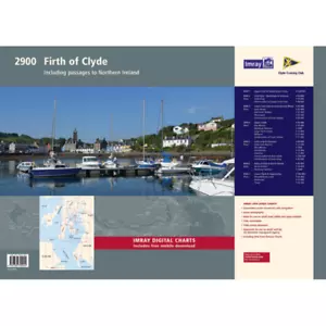
Imray Chart Pack 2900: Firth of Clyde including passages to Northern Ireland (Sp

GBP 64.95
ApproximatelyRM 368.73
Condition:
Brand New
A new, unread, unused book in perfect condition with no missing or damaged pages.
More than 10 available
Oops! Looks like we're having trouble connecting to our server.
Refresh your browser window to try again.
Shipping:
GBP 32.20 (approx RM 182.80) International Priority Shipping to United States via eBay's Global Shipping Program.
Located in: London, England, United Kingdom
Import charges:
Free amount confirmed at checkout
Delivery:
Estimated between Tue, 29 Jul and Thu, 7 Aug to 94104
Includes international tracking
Returns:
30 days return. Buyer pays for return shipping. If you use an eBay shipping label, it will be deducted from your refund amount.
Coverage:
Read item description or contact seller for details. See all detailsSee all details on coverage
(Not eligible for eBay purchase protection programmes)
Seller assumes all responsibility for this listing.
eBay item number:167302716326
Item specifics
- Condition
- Brand New: A new, unread, unused book in perfect condition with no missing or damaged pages. See all condition definitionsopens in a new window or tab
- Brand
- Imray
- Country/Region of Manufacture
- United Kingdom
- Publication Name
- N/A
- Series
- Imray Chart Packs
- Sub-Type
- Chart Pack
- Subject Area
- Nautical
- ISBN
- 9781786792280
About this product
Product Information
This complete redesign of our 2900 Firth of Clyde chart pack now include more detailed coverage of the area and comes as a paper and digital edition. Created in association with the Clyde Cruising Club for use alongside their sailing directions, coverage includes detail of this delightful area of Scotland with passages to Northern Ireland and references to the popular large scale Antares Charts. The 16 sheets in this pack provide all the necessary information for passage planning, detailed approach to yacht havens and marinas, and the numerous anchorages and sailing areas recommended for small craft. Coverage includes the Firth of Clyde, lochs to the north of the Upper Clyde, the Kyles of Bute and Loch Fyne, and Kilbrannan Sound to the Mull of Kintyre. This expanded edition also includes coverage of the North Channel, detailing passage from the Firth of Clyde and Loch Ryan to Belfast Lough. In A2 format, wiro-bound in a tough plastic wallet. Also available in loose-leaf A2 format in a tough plastic wallet, please refer to stock code ICic2900-2. Imray Digital Charts: Free mobile download A voucher code to download ID30 Imray digital charts into Imray Navigator (our app for iPad, iPhone and Android) is included with this pack. Charts included: 1. Firth of Clyde (1:210 000) 2. The North Channel (1:210 000) 3. Aisla Craig to Ayr (1:75 000) includes plans Girvan (1:6000), Ayr (1:10 000) 4. Ayr to Ardrossan (1:75 000) includes plans Troon (1:12 500), Irvine (1:17 500), Ardrossan (1:10 000) 5. Pladda to Lamlash Harbour (1:30 000) 6. South of Bute & the Cumbraes (1:30 000) includes plans MiIlport (1:15 000), Largs Yacht Haven (1:15 000) 7. Upper Clyde (1:50 000) includes plans Kip Marina (1:15 000), Rothesay Bay (1:10 000), Rothesay Harbour (1:5000) 8. Long Loch & Gareloch (1:50 000) includes plans Continuation of Long Loch (1:50 000), Continuation of River Clyde (1:100 000), Dumbarton (1:15 000), Bowling (1:15 000), Approaches to Rhu (1:15 000), Holy Loch Marina (1:12 500) 9. Kyles of Bute (1:30 000) includes plans Continuation of Loch Striven (1:30 000), Continuation of Loch Riddon (1:30 000), Port Bannatyne Marina (1:10 000), Burnt Islands (1:10 000), Caladh Harbour (1:10 000) 10. Inchmarnock Water (1:30 000) 11. Lower Loch Fyne (1:50 000) includes plans Portavadie (1:25 000), East Loch Tarbert (1:8000), Ardrishaig (1:10 000) 12. Upper Loch Fyne (1:50 000) includes plans Continuation of Loch Fyne (1:50 000), Loch Gair (1:25 000), Minard Narrows (1:25 000), Invaray (1:25 000) 13. Inchmarnock to Kilbrannan Sound (1:50 000) includes plan Loch Ranza (1:22 500) 14. Carradale to Sanda Island (1:75 000) includes plans Campbeltown Loch (1:35 000), Campbeltown Harbour (1:7500), Sanda Island (1:30 000) 15. Aisla Craig to Loch Ryan (1:75 000) includes plan Stranraer (1:12 500) 16. Belfast Lough to Carnlough (1:90 000) includes plans Carrickfergus (1:15 000), Bangor Bay (1:17 500)
Product Identifiers
Publisher
Imray, Laurie, Norie & Wilson LTD
ISBN-13
9781786792280
eBay Product ID (ePID)
17046507622
Product Key Features
Book Title
Imray Chart Pack 2900 Firth of Clyde Wiro Bound: Includes Passages to Northern Ireland
Book Series
2000 Series
Publication Year
2020
Type
Textbook
Format
Sheet Map
Language
English
Genre
Sports
Number of Pages
16 Pages
Dimensions
Item Height
590 mm
Item Weight
660 g
Item Width
840 mm
Volume
2900W
Additional Product Features
Country/Region of Manufacture
United Kingdom
Topic Area
Marine Science
Item description from the seller

Popular categories from this store
Seller feedback (486)
- Automatische Bewertung von eBay- Feedback left by buyer.Past monthBestellung erfolgreich durchgeführt - mit Sendungsverfolgung und fristgerecht
- Automatische Bewertung von eBay- Feedback left by buyer.Past monthBestellung erfolgreich durchgeführt - mit Sendungsverfolgung und fristgerecht
- Automatische Bewertung von eBay- Feedback left by buyer.Past monthBestellung erfolgreich durchgeführt - mit Sendungsverfolgung und fristgerecht