Picture 1 of 3


Gallery
Picture 1 of 3


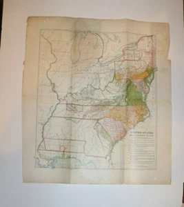
Vintage Map UNITED STATES DEVELOPMENT TO 1787 dated 1909 Matthews Northrup

US $29.43
ApproximatelyRM 126.40
Condition:
Oops! Looks like we're having trouble connecting to our server.
Refresh your browser window to try again.
Shipping:
US $5.00 (approx RM 21.47) USPS First Class®.
Located in: Lake Villa, Illinois, United States
Delivery:
Estimated between Fri, 27 Jun and Thu, 3 Jul to 94104
Returns:
30 days return. Buyer pays for return shipping. If you use an eBay shipping label, it will be deducted from your refund amount.
Coverage:
Read item description or contact seller for details. See all detailsSee all details on coverage
(Not eligible for eBay purchase protection programmes)
Seller assumes all responsibility for this listing.
eBay item number:163989566876
Item description from the seller

Popular categories from this store
Seller feedback (16,081)
- o***9 (7266)- Feedback left by buyer.Past monthVerified purchasePerfect, thank you!!!!!
- j***n (519)- Feedback left by buyer.Past monthVerified purchaseFast shipping, well packaged and a great value. A-1 seller!
- y***3 (43)- Feedback left by buyer.Past monthVerified purchase.
More to explore :
- United States of America 1900-1909 Date Range Antique North America Maps & Atlases,
- United States of America Mississippi Antique North America Maps & Atlases 1900-1909 Date Range,
- United States of America Wyoming Antique North America Maps & Atlases 1900-1909 Date Range,
- United States of America Maine Antique North America Maps & Atlases 1900-1909 Date Range,
- United States of America California Antique North America Maps & Atlases 1900-1909 Date Range,
- Vintage Reproduction 1900-1909 Date Range Antique Atlas Maps,
- 1900-1909 Date Range City Map Antique Folding Maps,
- 1900-1909 Date Range Antique Nautical Maps,
- 1900-1909 Date Range Antique County Maps,
- 1900-1909 Date Range Antique City Maps
Popular categories from this store
Seller feedback (16,081)
- o***9 (7266)- Feedback left by buyer.Past monthVerified purchasePerfect, thank you!!!!!
- j***n (519)- Feedback left by buyer.Past monthVerified purchaseFast shipping, well packaged and a great value. A-1 seller!
- y***3 (43)- Feedback left by buyer.Past monthVerified purchase.