Picture 1 of 3


Gallery
Picture 1 of 3


Have one to sell?
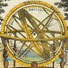
map England & Wales 1820 by Carey & Aspin original Geographical & Statistical

GBP 59.33
ApproximatelyRM 339.56
Condition:
“Good Condition - Please see description below”
Oops! Looks like we're having trouble connecting to our server.
Refresh your browser window to try again.
Returns:
No returns accepted.
Coverage:
Read item description or contact seller for details. See all detailsSee all details on coverage
(Not eligible for eBay purchase protection programmes)
Seller assumes all responsibility for this listing.
eBay item number:157275909526
Item specifics
- Seller Notes
- “Good Condition - Please see description below”
- Format
- Sheet Map
- Region
- British Isles
- Map Type
- Historical/ Political
- County
- Engliand & Wales
- Antique/ Modern
- Antique
- City
- London
- Country/Region
- England, Wales
- Cartographer/Publisher
- Cary & Aspin
- Date Range
- 1800-1899
- Type
- Atlas Map
Item description from the seller
Popular categories from this store
Seller feedback (1,854)
- eBay automated feedback- Feedback left by buyer.Past monthOrder completed successfully—tracked and on time
- eBay automated feedback- Feedback left by buyer.Past monthOrder completed successfully—tracked and on time
- eBay automated feedback- Feedback left by buyer.Past monthOrder completed successfully—tracked and on time
More to explore :
- Wales Antique Original Antique Europe Sheet Maps,
- Wales Antique Original Antique European Maps & Atlases,
- Wales Antique Original Antique Europe Atlas Maps,
- London Wales Antique Original Antique European Maps & Atlases,
- Wales Antique Europe Railroad Maps,
- Wales Antique Europe County Maps,
- Antique European Maps & Atlases Wales London,
- Wales Lithography Antique Europe Atlas Maps,
- Antique European Maps & Atlases Wales Lithography,
- England Cornwall Antique Original Antique European Maps & Atlases
Popular categories from this store
Seller feedback (1,854)
- eBay automated feedback- Feedback left by buyer.Past monthOrder completed successfully—tracked and on time
- eBay automated feedback- Feedback left by buyer.Past monthOrder completed successfully—tracked and on time
- eBay automated feedback- Feedback left by buyer.Past monthOrder completed successfully—tracked and on time