Picture 1 of 3


Gallery
Picture 1 of 3


Have one to sell?
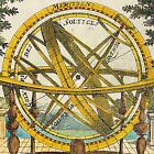
Tonga Tongatapu Sketch of Harbour South Pacific by Bowen colour 1785

GBP 85.00
ApproximatelyRM 485.95
Condition:
“"Used" Please check below for further Information”
Oops! Looks like we're having trouble connecting to our server.
Refresh your browser window to try again.
Shipping:
GBP 7.90 (approx RM 45.16) Royal Mail International Standard.
Located in: Buckinghamshire, United Kingdom
Delivery:
Estimated between Thu, 28 Aug and Mon, 15 Sep to 94104
Returns:
No returns accepted.
Coverage:
Read item description or contact seller for details. See all detailsSee all details on coverage
(Not eligible for eBay purchase protection programmes)
Seller assumes all responsibility for this listing.
eBay item number:157265676273
Item specifics
- Seller Notes
- “"Used" Please check below for further Information”
- Date Range
- 1700-1799
- Type
- Naval Chart
- Printing Technique
- Copper Plate
- Format
- Naval Chart
- Year
- 1785
- Era
- 1700s
- Cartographer/Publisher
- George Anderson / Alex Hogg
- Original/Reproduction
- Original
- Country/Region
- South Pacific, Tonga
Item description from the seller
Popular categories from this store
Seller feedback (1,850)
- eBay automated Feedback- Feedback left by buyer.Past monthOrder completed successfully – tracked and on time
- n***e (243)- Feedback left by buyer.Past monthVerified purchaseGreat product delivered quickly
- r***r (72)- Feedback left by buyer.Past monthVerified purchaseThank you so much for the print of the Crocus fairy by Cicely Mary Barker. The postage is good. The packaging is good. The item is as described and good value for money.
More to explore :
- Tonga Antique Australia/Oceania Maps & Atlases,
- Colour Pre - 1800 Indian Antiques,
- Colour Pre - 1800 Chinese Antiques,
- Blue Colour Antique Original Chinese Antiques,
- Blue Colour Pre - 1800 Asian Antiques,
- Colour Pre - 1800 Middle Eastern Antiques,
- Antique European Maps & Atlases Emanuel Bowen,
- Emanuel Bowen Copper Plate Antique Europe Maps & Atlases,
- Antique South America Folding Maps,
- Antique South America River Maps
Popular categories from this store
Seller feedback (1,850)
- eBay automated Feedback- Feedback left by buyer.Past monthOrder completed successfully – tracked and on time
- n***e (243)- Feedback left by buyer.Past monthVerified purchaseGreat product delivered quickly
- r***r (72)- Feedback left by buyer.Past monthVerified purchaseThank you so much for the print of the Crocus fairy by Cicely Mary Barker. The postage is good. The packaging is good. The item is as described and good value for money.