Picture 1 of 9


Gallery
Picture 1 of 9


Have one to sell?
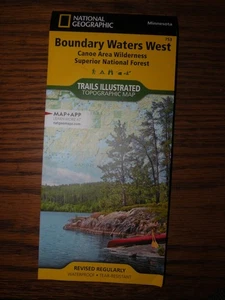
BOUNDARY WATERS WEST [CANOE AREA WILDERNESS, SUPERIOR By National Geographic MAP

US $16.52
ApproximatelyRM 69.66
Condition:
Brand New
A new, unread, unused book in perfect condition with no missing or damaged pages.
Oops! Looks like we're having trouble connecting to our server.
Refresh your browser window to try again.
Shipping:
US $4.47 (approx RM 18.85) USPS Media MailTM.
Located in: Langley, Washington, United States
Delivery:
Estimated between Tue, 14 Oct and Fri, 17 Oct to 94104
Returns:
30 days return. Seller pays for return shipping.
Coverage:
Read item description or contact seller for details. See all detailsSee all details on coverage
(Not eligible for eBay purchase protection programmes)
Seller assumes all responsibility for this listing.
eBay item number:146853925081
Item specifics
- Condition
- Brand New: A new, unread, unused book in perfect condition with no missing or damaged pages. See all condition definitionsopens in a new window or tab
- Type
- Map
- Publication Name
- Natl Geographic Society Maps
- Item Height
- 4 inches
- ISBN-10
- 1566955025
- ISBN
- 9781566955027
About this product
Product Identifiers
Publisher
National Geographic Maps
ISBN-10
1566955025
ISBN-13
9781566955027
eBay Product ID (ePID)
102906790
Product Key Features
Edition
2020
Book Title
Boundary Waters Canoe Area Wilderness : Superior National Forest
Number of Pages
1 Pages
Language
English
Topic
Maps & Road Atlases (See Also Reference / Atlases, Gazetteers & Maps), Canoeing, Special Interest / Hikes & Walks, Parks & Campgrounds, United States / MidWest / West North Central (IA, Ks, MN, Mo, Nd, Ne, Sd), Hiking
Publication Year
2020
Illustrator
Yes
Genre
Travel, Sports & Recreation
Book Series
National Geographic Trails Illustrated Map Ser.
Format
Sheet Map, Folded
Dimensions
Item Weight
3.2 Oz
Item Length
9.3 in
Item Width
4.3 in
Additional Product Features
Intended Audience
Trade
Series Volume Number
752
Synopsis
- Waterproof - Tear-Resistant - Topographic Map Visitors to the water-rich Boundary Waters Canoe Area Wilderness can enjoy solitude and primitive recreation in an area where early Native Americans, missionaries, and explorers once traveled. Expertly researched and created in partnership with local land management agencies, National Geographic's Trails Illustrated map of Boundary Waters East provides an unparalleled tool for exploring this region of Superior National Forest. Some of the key areas of interest featured on this map include Eagle Mountain, Lake Isabella State Forest, Chik-Wauk Museum Nature Center, Kekekabic and Border Route trails, and Gunflint Trail National Scenic Byway. Designed with a wide range of visitors in mind, this map features detailed and easy-to-read hiking, bike, snowmobile, cross-country ski and snowshoe trails, as well as portages, accurate road network, and contact information for local agencies. Boaters will appreciate the information on watercraft horsepower restrictions and the conversion table for distances. Other helpful recreation features noted are campgrounds, swimming and beach access, interpretive trails, fishing areas, boat launches, and carry down access areas. The map base includes contour lines and elevations for summits, passes and many lakes. Every Trails Illustrated map is printed on "Backcountry Tough" waterproof, tear-resistant paper. A full UTM grid is printed on the map to aid with GPS navigation. Other features found on this map include: Boundary Waters Canoe Area Wilderness, Eagle Mountain, Kelso Mountain, Misquah Hills, Saganaga Lake, Superior National Forest. Map Scale = 1:70,000 Sheet Size = 37.75" x 25.5" Folded Size = 4.25" x 9.25", National Geographic's Trails Illustrated Maps are the most detailed and up-to-date topographic recreation maps available for US National Parks, National Forests and other popular outdoor recreation areas. A necessity for exploring the outdoors, each map is printed on waterproof, tear-resistant material. They also contain key safety and contact information, GPS and compass coordinates, Leave No Trace ethical guidelines and hundreds of points-of-interest, including scenic viewpoints, campgrounds, boat launches, swimming areas, marine sanctuaries and wildlife refuges.
Item description from the seller

Seller feedback (6,121)
- eBay automated feedback- Feedback left by buyer.Past monthOrder delivered on time with no issues
- eBay automated feedback- Feedback left by buyer.Past monthOrder delivered on time with no issues
- eBay automated feedback- Feedback left by buyer.Past monthOrder delivered on time with no issues
More to explore :
- National Geographic Maps & Atlases,
- National Geographic World Maps & Atlases,
- National Geographic Folding Map Maps & Atlases,
- National Geographic Folding Maps Books,
- National Geographic Paperback Maps & Atlases,
- National Geographic Magazines,
- National Geographic Children Magazines,
- National Geographic Limited Edition Magazines,
- National Geographic Nonfiction Books & Fiction,
- Collector's Edition National Geographic Magazines
Seller feedback (6,121)
- eBay automated feedback- Feedback left by buyer.Past monthOrder delivered on time with no issues
- eBay automated feedback- Feedback left by buyer.Past monthOrder delivered on time with no issues
- eBay automated feedback- Feedback left by buyer.Past monthOrder delivered on time with no issues