Picture 1 of 1
Gallery
Picture 1 of 1

Have one to sell?
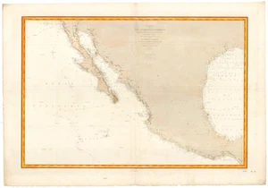
1863 (1887) French Nautical Chart of Mexico, Texas, Baja, U.S. Civil War-era

US $875.00
ApproximatelyRM 3,717.61
or Best Offer
Condition:
“Wear along edge. Thick paper. Watermark for Service Hydrographique in bottom margin. Hand-written ”... Read moreabout condition
Oops! Looks like we're having trouble connecting to our server.
Refresh your browser window to try again.
Shipping:
US $30.00 (approx RM 127.46) FedEx Ground or FedEx Home Delivery®.
Located in: Belvedere Tiburon, California, United States
Delivery:
Estimated between Tue, 22 Jul and Mon, 28 Jul to 94104
Returns:
14 days return. Buyer pays for return shipping. If you use an eBay shipping label, it will be deducted from your refund amount.
Coverage:
Read item description or contact seller for details. See all detailsSee all details on coverage
(Not eligible for eBay purchase protection programmes)
Seller assumes all responsibility for this listing.
eBay item number:146714695021
Item specifics
- Seller Notes
- Date Range
- 1800-1899
- Type
- Nautical Map
- Printing Technique
- Copper Plate
- US State
- AZ, CA, CO, NM, NV, UT, California, Texas
- Year
- 1887
- Original/Reproduction
- Antique Original
- Cartographer/Publisher
- Dépôt des cartes et plans de la Marine
Item description from the seller

Seller feedback (34)
- a***i (13865)- Feedback left by buyer.Past monthVerified purchaseGreat seller, wonderful item and shipped quickly. Thanks!!
- s***w (9777)- Feedback left by buyer.Past monthVerified purchaseprompt payment!
- 2***m (89)- Feedback left by buyer.Past yearVerified purchaseExcellent to work with. Item was exactly as described. Would definitely work with this seller again.[Sutro Baths] ON THE SHORE OF THE PACIFIC OCEAN (#145422041115)
More to explore :
- Civil War Maritime Antiques,
- Civil War Antique Model Ships,
- Civil War Antique Maritime Reproductions,
- Civil War Antique Maritime Compasses,
- Civil War Antique Maritime Portholes,
- Wooden Civil War Maritime Antiques,
- Civil War Antique Diving Helmets,
- Civil War Antique Maritime Lamps & Lighting,
- Civil War Antique Maritime Portholes & Hatches,
- US Navy Civil War Maritime Antiques
Seller feedback (34)
- a***i (13865)- Feedback left by buyer.Past monthVerified purchaseGreat seller, wonderful item and shipped quickly. Thanks!!
- s***w (9777)- Feedback left by buyer.Past monthVerified purchaseprompt payment!
- 2***m (89)- Feedback left by buyer.Past yearVerified purchaseExcellent to work with. Item was exactly as described. Would definitely work with this seller again.[Sutro Baths] ON THE SHORE OF THE PACIFIC OCEAN (#145422041115)