Picture 1 of 1
Gallery
Picture 1 of 1

Have one to sell?
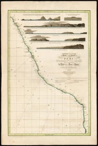
Rare 1805 Faden 'Spherical chart of part of the coast of Peru'

US $950.00
ApproximatelyRM 4,014.42
or Best Offer
Condition:
“Very good. Centerfold reinforced at margin. 56 x 85 cm (22 x 33.5 in)”
Oops! Looks like we're having trouble connecting to our server.
Refresh your browser window to try again.
Shipping:
US $30.00 (approx RM 126.77) FedEx Ground / FedEx Home Delivery®.
Located in: Belvedere Tiburon, California, United States
Delivery:
Estimated between Mon, 8 Sep and Thu, 11 Sep to 94104
Returns:
14 days return. Buyer pays for return shipping. If you use an eBay shipping label, it will be deducted from your refund amount.
Coverage:
Read item description or contact seller for details. See all detailsSee all details on coverage
(Not eligible for eBay purchase protection programmes)
Seller assumes all responsibility for this listing.
eBay item number:146708524565
Item specifics
- Seller Notes
- “Very good. Centerfold reinforced at margin. 56 x 85 cm (22 x 33.5 in)”
- Date Range
- 1800-1899
- Printing Technique
- Copper Plate
- Year
- 1805
- Original/Reproduction
- Antique Original
- Country/Region
- Peru
Item description from the seller

Seller feedback (36)
- v***n (567)- Feedback left by buyer.Past monthVerified purchaseSoooo cool! Thanks.
- w***a (826)- Feedback left by buyer.Past monthVerified purchaseGreat vendor! A++++ Excellent packaging. Wonderful item.
- a***i (13918)- Feedback left by buyer.Past 6 monthsVerified purchaseGreat seller, wonderful item and shipped quickly. Thanks!!
More to explore :
- US Coast Guard Antique Maritime Navigational Charts,
- Antique Maritime Navigational Charts,
- WWII Antique Maritime Navigational Charts,
- Australia Antique Maritime Navigational Charts,
- Peru Antique South America Atlas Maps,
- Peru Antique South America Folding Maps,
- Antique South American Maps Peru Lithography Atlases,
- United Kingdom Antique Maritime Navigational Charts,
- Peru Copper Plate Antique South America Maps & Atlases,
- Antique Original WWII Antique Maritime Navigational Charts
Seller feedback (36)
- v***n (567)- Feedback left by buyer.Past monthVerified purchaseSoooo cool! Thanks.
- w***a (826)- Feedback left by buyer.Past monthVerified purchaseGreat vendor! A++++ Excellent packaging. Wonderful item.
- a***i (13918)- Feedback left by buyer.Past 6 monthsVerified purchaseGreat seller, wonderful item and shipped quickly. Thanks!!