Picture 1 of 10


Gallery
Picture 1 of 10


Have one to sell?
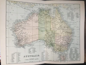
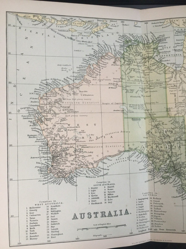
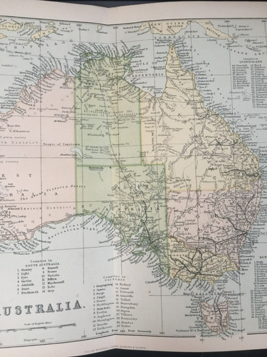
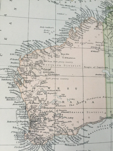
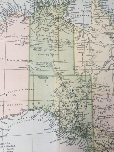
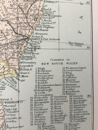
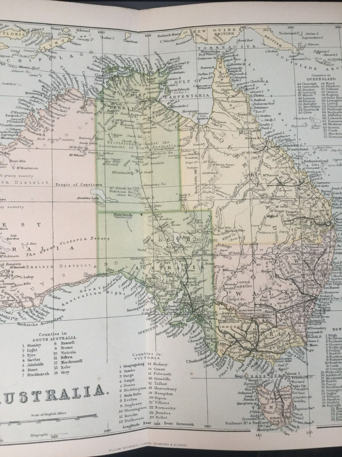
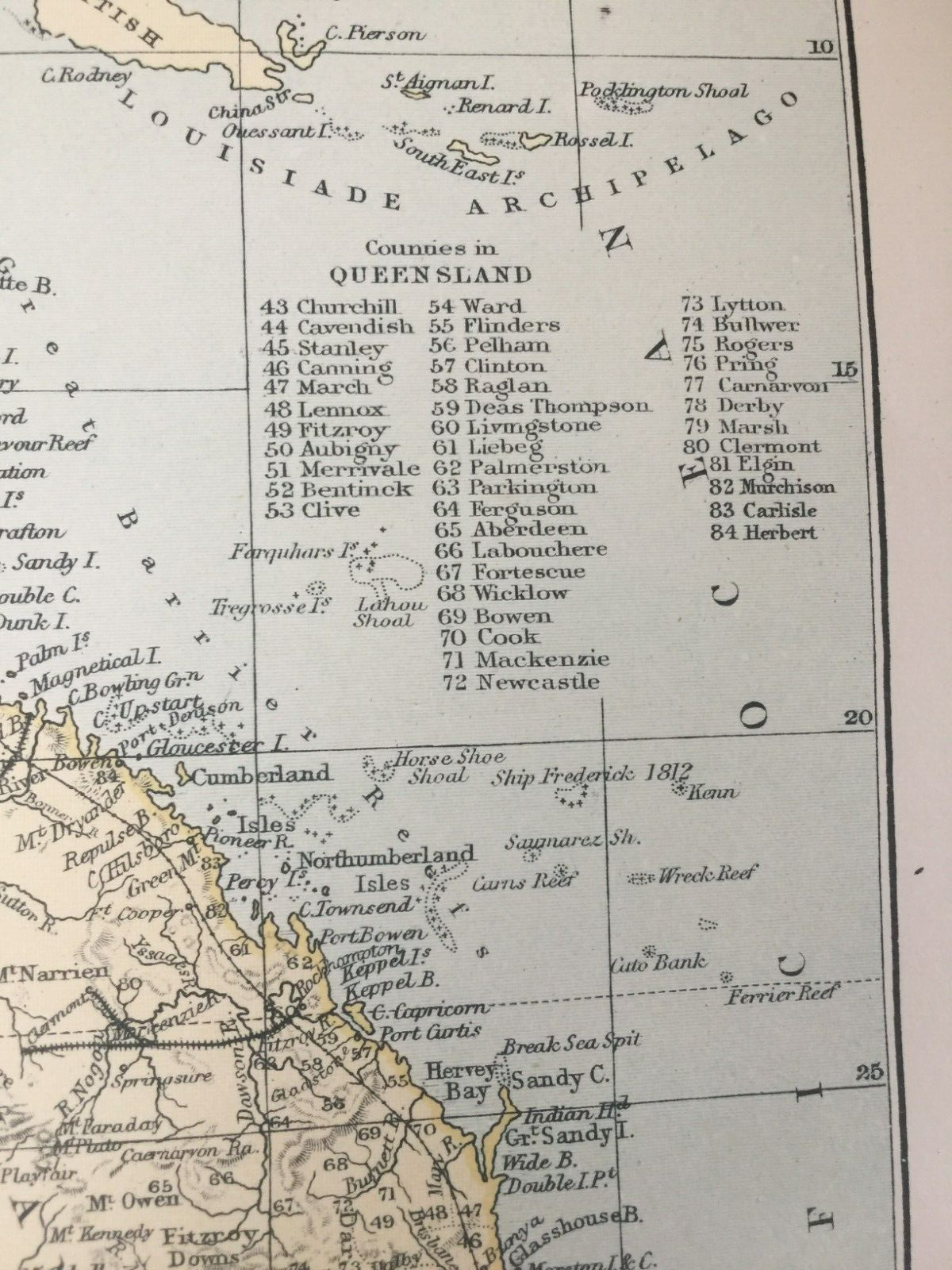
Original 1870s Map of Australia | Colonial Terrain & Victorian Cartography

GBP 13.99
ApproximatelyRM 79.58
Condition:
Oops! Looks like we're having trouble connecting to our server.
Refresh your browser window to try again.
Shipping:
GBP 4.95 (approx RM 28.16) Standard Int'l Postage.
Located in: Great Torrington, Devon, United Kingdom
Delivery:
Estimated between Mon, 25 Aug and Tue, 9 Sep
Ships today if you order in the next 48 mins
Returns:
No returns accepted.
Coverage:
Read item description or contact seller for details. See all detailsSee all details on coverage
(Not eligible for eBay purchase protection programmes)
Seller assumes all responsibility for this listing.
eBay item number:136326487466
Item specifics
- Antique
- Yes
- Date Range
- 1800-1899
- Type
- World Atlas
- Printing Technique
- Lithography
- Format
- Sheet Map
- Year
- 1870
- Era
- 1800s
- State/Territory
- New South Wales
- Original/Reproduction
- Antique Original
- Cartographer/Publisher
- William Mackenzie
- City
- Adelaide
- Country/Region
- Australia
Item description from the seller

Seller feedback (4,169)
- eBay automated Feedback- Feedback left by buyer.Past monthOrder completed successfully – tracked and on time
- v***i (404)- Feedback left by buyer.Past monthVerified purchaseGood service, many thanks
- eBay automated Feedback- Feedback left by buyer.Past monthOrder completed successfully – tracked and on time
More to explore :
- Australia Vintage Original Antique Australia/Oceania Maps & Atlases,
- Australia Vintage Original Antique Australia/Oceania Atlas Maps,
- Australia Antique Original Antique Australia/Oceania Maps & Atlases,
- Australia Antique Original Western Australia Antique Australia/Oceania Maps & Atlases,
- Australia South Australia Antique Original Antique Australia/Oceania Maps & Atlases,
- Antique Original Topographical Map Antique Australia/Oceania Atlas Maps,
- Antique Original Antique Australia/Oceania Topographical Maps,
- Vintage Original Antique Australia/Oceania Maps & Atlases,
- Vintage Original Antique Australia/Oceania Atlas Maps,
- Australia Antique Australia/Oceania Physical Maps
Seller feedback (4,169)
- eBay automated Feedback- Feedback left by buyer.Past monthOrder completed successfully – tracked and on time
- v***i (404)- Feedback left by buyer.Past monthVerified purchaseGood service, many thanks
- eBay automated Feedback- Feedback left by buyer.Past monthOrder completed successfully – tracked and on time