Picture 1 of 2

Gallery
Picture 1 of 2


Have one to sell?
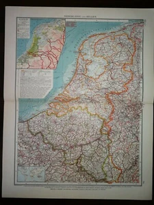
DOUBLE-PAGE MAP-NETHERLAND

GBP 15.00
ApproximatelyRM 82.04
or Best Offer
Condition:
Oops! Looks like we're having trouble connecting to our server.
Refresh your browser window to try again.
Returns:
No returns accepted.
Coverage:
Read item description or contact seller for details. See all detailsSee all details on coverage
(Not eligible for eBay purchase protection programmes)
About this item
Seller assumes all responsibility for this listing.
eBay item number:133442404729
Item specifics
- Year
- 1914
- Format
- Atlas Map
- Era
- 1914
- Cartographer/Publisher
- RICHARD ANDREE
- Type
- World Atlas
- Original/Reproduction
- Vintage Original
- Date Range
- 1914
Item description from the seller

Seller feedback (359)
- u***z (699)- Feedback left by buyer.Past 6 monthsVerified purchaseShipping - fast. Packaging - professionally packed. Item - as described. Value - worth buying.
- a***a (186)- Feedback left by buyer.Past yearVerified purchaseExcellent service, product was better than described, fairly priced, well packaged and promptly posted. Highly recommended seller.ANTIQUE ORIGINAL B/W ENGRAVING-HOLY LAND &NEAR EAST-WILDERNESS OF SINAI -1860CA (#135485960900)
- v***g (2376)- Feedback left by buyer.Past 6 monthsVerified purchaseVery fast delivery, safely packed. Rare item, condition exactly as described. Good sellerANTIQUE ORIGINAL HAND COLOUR ENGRAVING-NORRIS THE PRIORY , ISLE OF WIGHT- 1835 (#134388180860)
More to explore :
- Belgium Antique Europe Atlas Maps,
- Netherlands Antique Europe Atlas Maps,
- Belgium City Map Antique Europe Atlas Maps,
- Belgium County Map Antique Europe Atlas Maps,
- Belgium Political Map Antique Europe Atlas Maps,
- World Atlas Antique World Atlas Maps,
- Lithography World Atlas Antique World Atlas Maps,
- Vintage Original World Atlas Antique World Atlas Maps,
- Physical Map Antique World Atlas Maps,
- Lithography World Antique World Atlas Maps
Seller feedback (359)
- u***z (699)- Feedback left by buyer.Past 6 monthsVerified purchaseShipping - fast. Packaging - professionally packed. Item - as described. Value - worth buying.
- a***a (186)- Feedback left by buyer.Past yearVerified purchaseExcellent service, product was better than described, fairly priced, well packaged and promptly posted. Highly recommended seller.ANTIQUE ORIGINAL B/W ENGRAVING-HOLY LAND &NEAR EAST-WILDERNESS OF SINAI -1860CA (#135485960900)
- v***g (2376)- Feedback left by buyer.Past 6 monthsVerified purchaseVery fast delivery, safely packed. Rare item, condition exactly as described. Good sellerANTIQUE ORIGINAL HAND COLOUR ENGRAVING-NORRIS THE PRIORY , ISLE OF WIGHT- 1835 (#134388180860)