River Map Antique Folding Maps
All
Auction
Buy It Now
85 Results
Map: Up the Amazon & Madeira Rivers. For book by E D Mathews 1879 original.
RM 929.28RM 58.08 shipping1882 Map of the Rovuma River Tanzania Mozambique antique vintage
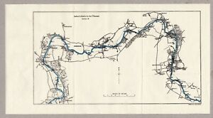
RM 357.74RM 141.01 shippingOriginal Map of River Thames Cirencester to Northmoor 1950 14" x 5.5"
RM 149.06RM 48.59 shipping1882 Map of the Shaktu Valley Punjab Waziristan Pakistan antique vintage
RM 178.87RM 141.43 shippingTHE ADVANCE TO THE RIVER SEINE & LIBERATION OF PARIS, WW2 Map of OVERLORD 1944
RM 29.75RM 17.59 shippingOPERATIONS TO CLEAR TYHE WEST BANK OF THE RIVER MAAS 1944, WW2 Map
RM 20.87RM 17.59 shippingARNHEM AND THE THREE RIVERS 17 Sept 1944, WW2 Map
RM 22.36RM 17.59 shipping1920s-1930s Relief-Panorama of the Rhine, Color Foldout Map, Hoursch 64" long
RM 119.26RM 129.76 shippingMap. A. Legun "Upper Don" Table of riffles. No 15 Russian Empire.
RM 119.31RM 52.50 shippingMap. A. Legun "Upper Don" Riffles. No 13 Russian Empire.
RM 167.04RM 52.50 shippingMap. A. Legun "Upper Don" Riffles. No 14 Russian Empire.
RM 167.04RM 52.50 shippingMap. A. Legun "Upper Don" No 11 Russian Empire.
RM 167.04RM 52.50 shippingNew ListingVintage Rhine Fold Out Map Gorgeous Color No Rips or Tears Der Rhein German Map
RM 167.04RM 124.99 shippingOriginal Map of River Thames Benson to Purley 1950 8.75" x 5"
RM 149.06RM 48.59 shipping1882 Map of Sources Irawadi River Pundit Journey Tibet Assam antique vintage
RM 357.74RM 117.81 shippingOriginal Map of River Thames Boveney via Windsor to Staines 1950 8.5" x 5"
RM 149.06RM 48.59 shipping1882 Map of Marhatta Country Bombay Mumbai India antique vintage
RM 59.62RM 107.50 shippingTHE CROSSING OF THE RIVER SEINE 21 ARMY GROUP 25-27 AUG 1944, WW2 OVERLORD Map
RM 25.34RM 17.59 shippingTHE DEVELOPMENT OF ALLIED OPERATIONS EAST OF THE RHINE March/April 1945 WW2 Map
RM 23.79RM 17.59 shippingMap. A. Legun "Upper Don" drawing of a barge, Stone caravan barge. No12 Russia.
RM 167.04RM 52.50 shippingStanfords Canoeing Map England & Wales c1968 Scale 14 miles - Inch Rivers Canals
RM 47.70RM 174.69 shippingPanorama of the Rhine (Panorama des Rheins), Delkeskamp, 1837
RM 321.96RM 128.49 shippingMap. Improving navigation conditions in the rapids part of the Danube River.
RM 357.94RM 85.90 shippingc.1930's Blake's Folding Map of the Rivers & Broads of Norfolk & Suffolk
RM 178.87RM 41.74 shipping1972 Army Engineers Folded Map OHIO RIVER BASIN MAP, PLAN OF DEVELOPMENT
RM 19.09RM 109.72 shippingVintage New York Map Delaware and Hudson River Canal w/Railroads Mines 1828 1898
RM 554.75Was: RM 596.51RM 139.26 shippingVINTAGE 1990 Creative Cartoon MAP OF SOLDOTNA ALASKA Kenai River
RM 238.58RM 137.69 shipping1855 COAST SURVEY MAP ~ LONG ISLAND, N.J., DE, CT, R.I. ~ HUDSON RIVER
RM 95.21RM 118.79 shippingOriginal Map of River Thames Northmoor to Oxford & Sandford 1950 7.25" x 5.25"
RM 149.06RM 48.59 shippingOriginal Map of River Thames Purley via Reading to Wargrave 1950 9" x 6"
RM 149.06RM 48.59 shippingOriginal Map of River Thames Nuneham & Abingdon to Benson 1950 8" x 6"
RM 149.06RM 48.59 shippingOriginal Map of River Thames Wargrave via Maidenhead to Boveney 1950 10.5" x 6"
RM 149.06RM 48.59 shipping1907 Rand, McNally & Co. Pocket Alaska Map Folding Towns Lakes Rivers Populat
RM 537.96Was: RM 597.76RM 110.39 shippingStanfords Canoeing Map England & Wales c1968 Scale 14 miles - Inch Rivers Canals
RM 59.56RM 165.51 shipping1930 Motor Routes Virginia Seashore Folding Map James River Bridge Am Auto Assoc
RM 238.62RM 104.33 shippingAntique Nouveau Panorama Du Rhin From Mannheim To Cologne D Kapp Fold Out Book
RM 461.60RM 144.94 shippingLower Deschutes River Public Lands Map, 1990s/early 2000s?
RM 33.41RM 109.82 shippingUpper Missouri National Wild & Scenic River Maps 3 & 4, Dept Of The Interior.
RM 16.47RM 77.41 shipping1885 Antique Map of the Rhine - Mayence to Coblenz - Virtue & Co Ltd 13" x 10.5"
RM 149.06RM 80.49 shippingOriginal Map of River Thames Staines to Hampton Wick 1950 9.25" x 5"
RM 89.43RM 48.59 shippingUSDA National Forest Service Map WHITE RIVER - Colorado - 1979 revised 1985 -
RM 108.91Was: RM 128.14RM 80.13 shipping1940's CHESTER-BRIDGEPORT FERRY Map Delaware River New Jersey Pennsylvania
RM 38.18RM 120.22 shippingCOAST GEODETIC SURVEY COLUMBIA RIVER PACIFIC OCEAN TO HARRINGTON POINT MAP 1958
RM 61.99RM 121.89 shippingStanfords Map Of The River Thames Lechlade To Hammersmith, 2000 Edition Vintage
RM 29.51RM 115.37 shipping1st Ed. Antique 1889 Victorian Map Up Down the River Bennet's Map & Guide Thames
RM 2,981.14RM 337.11 shippingOriginal 1936 Map NEW GUINEA Headwaters of Purari and Yuat Rivers 20.50in x 1
RM 142.33RM 37.73 shippingLondon Panorama of the River Thames, Oxford to London, C.W.Bacon Original c 1890
RM 4,620.77RM 1,126.87 shippingAntique NY Map Fort Bull William Mohawk River Wood Creek French Indian War 1849
RM 104.95Was: RM 119.26RM 117.31 shippingVintage NEW ORLEANS LA Visitor's Guide MAP - Mississippi River Steamer President
RM 64.43RM 120.98 shippingVintage U.S. Coast & Geodetic Survey Map Long Island Sound East River 1942
RM 95.45RM 133.49 shippingVintage FISHING MAP CARIBOU BRITISH COLUMBIA CANADA Sport Fishing Canada Lakes
RM 85.67RM 117.07 shippingTijuana River Estuarine Reserve Map San Diego CA Border Field State Park Imperia
RM 28.63RM 103.28 shippingAntique Map Susquehanna Delaware Mohawk River Property Grants w/Names 1849 Pease
RM 419.93Was: RM 477.20RM 126.61 shippingFolded Color Soil Survey Map Russell Kansas Bunker Hill Smoky Hill River 1903
RM 214.76RM 119.93 shippingFOLDING SKETCH MAP BATTLE PLAN PENINSULAR WAR RIVERS DOURO AND MINHO SOULT 1809
RM 83.41RM 11.92 shippingHidden River Mammoth Onyx Cave Map 1931
RM 71.54RM 86.81 shippingTHE RHINE (1964) Fold-Out Historical Map, German River, Germany, 42 x 7 Inches
RM 129.38RM 101.13 shippingLake Tawakoni & Iron Bridge Dam Folding Map Sabine River Texas
RM 61.99RM 120.17 shippingCarte de Pilotage du Danube du km 1880 (Devin) au hm 1707 (Szob) échelle 1:10000
RM 228.60RM 118.84 shippingVintage West Branch Watershed Map of Westfield River 1964 11” X 14”
RM 76.36RM 103.90 shipping