Hi !Hi! Sign in or registerHelp & Contact
Sell
My eBay
  • Summary
  • Recently Viewed
  • Bids/Offers
  • Watch List
  • Purchase History
  • Selling
  • Saved feed
  • Saved Searches
  • Saved Sellers
  • Messages
Please sign-in to view notifications.
Loading...
eBay Home
Advanced
Copyright © 1995-2025 eBay Inc. All Rights Reserved. User Agreement, Privacy, Payments Terms of Use, Cookies and AdChoice

Physical Map Antique Sheet Maps

breadcrumb

  • eBay
    • Collectibles & Art
    • Antiques
  • Collectibles & Art
  • Antiques
  • Maps, Atlases & Globes
  • Physical Map Antique Sheet Maps

Shop by category

  • Antiques
    • Maps, Atlases & Globes
    • Africa Maps
    • Asia Maps
    • Australia/Oceania Maps
    • Celestial Maps
    • Central America/Caribbean Maps
    • Curiosities Maps
    • Digital Maps
    • Europe Maps
    • Map & Globe Mixed Lots
    • Map & Globe Reproductions
    • North America Maps
    • South America Maps
    • World & Celestial Globes
    • World Maps
  • All Listings
  • Auction
  • Buy It Now
  • Best Match
  • Time: ending soonest
  • Time: newly listed
  • Price + Shipping: lowest first
  • Price + Shipping: highest first
  • Distance: nearest first
  • List View
  • Gallery View

889 results

Sort: Best Match

  • Best Match
  • Time: ending soonest
  • Time: newly listed
  • Price + Shipping: lowest first
  • Price + Shipping: highest first
  • Distance: nearest first
    • Type: Physical Map- Selected
    • Format: Sheet Map- Selected
    Clear All

    • 1728  VERY RARE Herman Moll Map , Genuine, FRAMED Greece cartography - Image 1 of 3
    • 1728  VERY RARE Herman Moll Map , Genuine, FRAMED Greece cartography - Image 2 of 3
    • 1728  VERY RARE Herman Moll Map , Genuine, FRAMED Greece cartography - Image 3 of 3

    1728 VERY RARE Herman Moll Map , Genuine, FRAMED Greece cartography

    RM 1,143.22
    or Best Offer
    RM 57.11 shipping
    S⁣S⁣T⁣р⁣ ⁣o⁣J⁣4⁣n⁣ ⁣s⁣6⁣3⁣o⁣ ⁣r⁣e⁣d⁣⁣⁣⁣⁣⁣⁣I⁣⁣S⁣⁣
    • Descripcion del Districto Audiencia de la Nueva Galicia Antonio Herrera 1726 XF - Image 1 of 4
    • Descripcion del Districto Audiencia de la Nueva Galicia Antonio Herrera 1726 XF - Image 2 of 4
    • Descripcion del Districto Audiencia de la Nueva Galicia Antonio Herrera 1726 XF - Image 3 of 4
    • Descripcion del Districto Audiencia de la Nueva Galicia Antonio Herrera 1726 XF - Image 4 of 4

    Descripcion del Districto Audiencia de la Nueva Galicia Antonio Herrera 1726 XF

    RM 1,058.75
    or Best Offer
    RM 33.88 shipping
    3⁣S⁣Q⁣p⁣ ⁣o⁣n⁣ѕ⁣o⁣M⁣T⁣r⁣ ⁣e⁣d⁣R⁣4⁣ ⁣⁣Z⁣⁣⁣⁣⁣⁣L⁣ ⁣⁣
    • RARE Frame Scotland Map 1952 Mid Century Large Scottish Clan Tartan Vintage #mcm - Image 1 of 4
    • RARE Frame Scotland Map 1952 Mid Century Large Scottish Clan Tartan Vintage #mcm - Image 2 of 4
    • RARE Frame Scotland Map 1952 Mid Century Large Scottish Clan Tartan Vintage #mcm - Image 3 of 4
    • RARE Frame Scotland Map 1952 Mid Century Large Scottish Clan Tartan Vintage #mcm - Image 4 of 4

    RARE Frame Scotland Map 1952 Mid Century Large Scottish Clan Tartan Vintage #mcm

    RM 2,000.74
    or Best Offer
    RM 223.23 shipping
    15 watching
    U⁣S⁣X⁣p⁣о⁣ ⁣4⁣n⁣J⁣ ⁣X⁣s⁣M⁣ ⁣o⁣Z⁣r⁣e⁣d⁣C⁣ ⁣5⁣P⁣⁣⁣ ⁣⁣⁣
    • Antique Map "Océanie" V. Lavasseur, 1850 Framed RARE FIND - Image 1 of 4
    • Antique Map "Océanie" V. Lavasseur, 1850 Framed RARE FIND - Image 2 of 4
    • Antique Map "Océanie" V. Lavasseur, 1850 Framed RARE FIND - Image 3 of 4
    • Antique Map "Océanie" V. Lavasseur, 1850 Framed RARE FIND - Image 4 of 4

    Antique Map "Océanie" V. Lavasseur, 1850 Framed RARE FIND

    RM 2,117.50
    RM 587.01 shipping
    S⁣0⁣p⁣o⁣n⁣s⁣о⁣W⁣r⁣e⁣ ⁣Z⁣N⁣d⁣⁣ ⁣⁣U⁣B⁣ ⁣U⁣S⁣⁣⁣ ⁣O⁣M⁣⁣
  • Antique "A New and Accurate Map of New South Wales" (Australia) Wilkinson, 1794 - Image 1 of 4

    Antique "A New and Accurate Map of New South Wales" (Australia) Wilkinson, 1794

    RM 1,657.76
    or Best Offer
    RM 102.90 shipping
    ⁣3⁣⁣⁣⁣6⁣⁣ ⁣7⁣⁣⁣⁣⁣⁣Z⁣ ⁣P⁣⁣H⁣⁣⁣⁣⁣⁣ ⁣B⁣⁣J⁣
  • Antique Map "Description De La Tartarie" (Tartarian Empire) Nicolas Sanson, 1654 - Image 1 of 4

    Antique Map "Description De La Tartarie" (Tartarian Empire) Nicolas Sanson, 1654

    RM 1,486.26
    or Best Offer
    RM 102.90 shipping
    12 watching
    V⁣L⁣ ⁣⁣⁣⁣⁣⁣T⁣A⁣ ⁣Q⁣P⁣⁣ ⁣6⁣⁣O⁣⁣ ⁣⁣Q⁣U⁣⁣ ⁣⁣⁣⁣
  • Antique View "Vue Du Lac De Neuchatel" (Switzerland) Lory, 1822 - Image 1 of 3

    Antique View "Vue Du Lac De Neuchatel" (Switzerland) Lory, 1822

    RM 714.55
    or Best Offer
    RM 102.90 shipping
    ⁣D⁣⁣G⁣⁣⁣⁣⁣⁣ ⁣⁣8⁣9⁣⁣⁣ ⁣⁣2⁣⁣X⁣ ⁣⁣L⁣⁣⁣H⁣⁣⁣
  • Antique Map "Terra Sancta" (Holy Land) Mercator - Hondius, c.1610 - Image 1 of 4

    Antique Map "Terra Sancta" (Holy Land) Mercator - Hondius, c.1610

    RM 3,029.69
    or Best Offer
    RM 102.90 shipping
    ⁣⁣E⁣⁣0⁣ ⁣⁣⁣V⁣⁣⁣⁣⁣⁣⁣⁣⁣⁣⁣⁣⁣⁣6⁣ ⁣⁣⁣U⁣⁣
  • Antique Map "L'Asia Secondo Le ultime osservazioni" Cassini, 1788 - Image 1 of 4

    Antique Map "L'Asia Secondo Le ultime osservazioni" Cassini, 1788

    RM 2,743.87
    or Best Offer
    RM 102.90 shipping
    ⁣⁣A⁣2⁣⁣⁣ ⁣Q⁣8⁣⁣ ⁣X⁣⁣⁣9⁣ ⁣J⁣⁣⁣K⁣⁣⁣⁣⁣⁣⁣ ⁣⁣
  • Map "Carte Phytostatique de L'Ile de Ténériffe" (Tenerife-Spain) Bertelot, 1835 - Image 1 of 4

    Map "Carte Phytostatique de L'Ile de Ténériffe" (Tenerife-Spain) Bertelot, 1835

    RM 4,573.12
    or Best Offer
    RM 102.90 shipping
    ⁣J⁣Q⁣ ⁣⁣⁣D⁣E⁣⁣ ⁣⁣⁣⁣⁣⁣B⁣⁣⁣4⁣ ⁣T⁣F⁣ ⁣5⁣⁣Q⁣ ⁣8⁣
  • Map "Transsylvaniae Tabula" (Romania) Sebastian Munster, 1572 - Image 1 of 3

    Map "Transsylvaniae Tabula" (Romania) Sebastian Munster, 1572

    RM 1,714.92
    or Best Offer
    RM 102.90 shipping
    17 watching
    ⁣⁣R⁣⁣⁣⁣⁣⁣⁣⁣⁣⁣⁣6⁣⁣ ⁣C⁣B⁣⁣⁣⁣ ⁣S⁣⁣8⁣⁣ ⁣⁣
  • Map "Le Provincie di Zelanda, Utrecht, Gheldria" (Southern Netherlands) 1778 - Image 1 of 4

    Map "Le Provincie di Zelanda, Utrecht, Gheldria" (Southern Netherlands) 1778

    RM 571.64
    or Best Offer
    RM 102.90 shipping
    ⁣⁣I⁣⁣⁣3⁣ ⁣⁣4⁣⁣H⁣⁣⁣ ⁣K⁣⁣R⁣⁣ ⁣⁣V⁣⁣⁣H⁣ ⁣⁣N⁣B⁣
  • Antique Map "Holand" (Netherlands) S. Munster, 1550 - Image 1 of 3

    Antique Map "Holand" (Netherlands) S. Munster, 1550

    RM 1,143.28
    or Best Offer
    RM 102.90 shipping
    ⁣⁣T⁣⁣⁣Q⁣⁣ ⁣U⁣⁣⁣9⁣ ⁣S⁣⁣M⁣ ⁣⁣⁣⁣U⁣Q⁣ ⁣⁣⁣⁣⁣⁣
  • 1959: Map Of Australia Physical Inset Political Australasia Vintage Print#58/59 - Image 1 of 4

    1959: Map Of Australia Physical Inset Political Australasia Vintage Print#58/59

    RM 74.03
    or Best Offer
    RM 124.62 shipping
    S⁣9⁣Q⁣р⁣ ⁣A⁣o⁣L⁣n⁣ ⁣X⁣s⁣o⁣r⁣e⁣F⁣d⁣ ⁣V⁣Q⁣ ⁣V⁣⁣⁣⁣⁣⁣⁣
  • 1950: Map Of New Zealand Physical CN #127 Print Southern Polar Regions - Image 1 of 4

    1950: Map Of New Zealand Physical CN #127 Print Southern Polar Regions

    RM 56.88
    or Best Offer
    RM 123.99 shipping
    7⁣F⁣ ⁣5⁣S⁣p⁣o⁣H⁣ ⁣n⁣s⁣o⁣Q⁣r⁣8⁣ ⁣е⁣3⁣4⁣d⁣ ⁣E⁣A⁣ ⁣6⁣⁣⁣⁣
  • Map Of Atlantic Ocean Physical Print 1996 TA Bartholomew Times #102 103 B - Image 1 of 4

    Map Of Atlantic Ocean Physical Print 1996 TA Bartholomew Times #102 103 B

    RM 22.58
    RM 122.85 shipping
    0⁣H⁣ ⁣Q⁣3⁣ ⁣S⁣p⁣R⁣о⁣n⁣s⁣Z⁣ ⁣4⁣o⁣D⁣r⁣ ⁣e⁣d⁣W⁣0⁣⁣ ⁣N⁣⁣⁣
  • 1685 4 SMALL MAPS OF MOLUCCAS GAMALAMA VOLCANO SURATE INDONESIA ASIA INDIA CHINA - Image 1 of 4

    1685 4 SMALL MAPS OF MOLUCCAS GAMALAMA VOLCANO SURATE INDONESIA ASIA INDIA CHINA

    RM 57.11
    or Best Offer
    RM 85.75 shipping
    ⁣⁣⁣X⁣⁣⁣⁣⁣⁣⁣⁣P⁣ ⁣⁣R⁣⁣⁣Z⁣⁣⁣ ⁣⁣⁣3⁣J⁣⁣ ⁣⁣
  • Antique Map "Sumatra Insula" S. Munster, 1572 - Image 1 of 2

    Antique Map "Sumatra Insula" S. Munster, 1572

    RM 600.22
    or Best Offer
    RM 102.90 shipping
    ⁣⁣7⁣⁣⁣X⁣⁣ ⁣8⁣C⁣ ⁣⁣C⁣⁣⁣⁣⁣⁣⁣M⁣⁣⁣ ⁣⁣⁣W⁣7⁣⁣
  • Antique Map "Neueste Karte von Mexico"  Meyer & Radefeld, 1845 - Image 1 of 4

    Antique Map "Neueste Karte von Mexico" Meyer & Radefeld, 1845

    RM 2,572.38
    or Best Offer
    RM 102.90 shipping
    ⁣9⁣⁣X⁣⁣⁣ ⁣⁣⁣R⁣⁣⁣F⁣⁣ ⁣⁣3⁣⁣E⁣ ⁣⁣⁣A⁣⁣K⁣ ⁣⁣⁣
  • Map "Het Heylige Land verdeeld in de Twaalf Stammen Israels" (Holy Land) c. 1700 - Image 1 of 4

    Map "Het Heylige Land verdeeld in de Twaalf Stammen Israels" (Holy Land) c. 1700

    RM 1,143.28
    or Best Offer
    RM 102.90 shipping
    ⁣I⁣⁣⁣⁣T⁣ ⁣⁣⁣U⁣7⁣⁣ ⁣⁣0⁣L⁣⁣⁣⁣⁣ ⁣W⁣⁣U⁣ ⁣D⁣⁣1⁣
  • Antique Map "Totius Americae Septentrionalis et Meridionalis" J. B. Homann, 1740 - Image 1 of 4

    Antique Map "Totius Americae Septentrionalis et Meridionalis" J. B. Homann, 1740

    RM 4,458.79
    or Best Offer
    RM 102.90 shipping
    16 watching
    V⁣N⁣⁣ ⁣T⁣⁣⁣P⁣ ⁣V⁣⁣B⁣⁣ ⁣D⁣V⁣ ⁣Q⁣T⁣ ⁣⁣E⁣⁣⁣⁣⁣ ⁣⁣
  • Lot of 3 Russia Engravings - Middleton, 1778 - Image 1 of 4

    Lot of 3 Russia Engravings - Middleton, 1778

    RM 714.55
    or Best Offer
    RM 102.90 shipping
    9⁣J⁣⁣⁣⁣⁣ ⁣M⁣9⁣ ⁣⁣L⁣⁣S⁣⁣⁣ ⁣⁣⁣⁣2⁣5⁣ ⁣2⁣⁣Z⁣⁣ ⁣
  • Map "L'Expédition d'Alexandre" (Alexander the Great/Middle-East) D'Anville, 1740 - Image 1 of 4

    Map "L'Expédition d'Alexandre" (Alexander the Great/Middle-East) D'Anville, 1740

    RM 1,229.03
    or Best Offer
    RM 102.90 shipping
    ⁣⁣F⁣0⁣⁣⁣⁣⁣⁣⁣⁣ ⁣⁣⁣⁣⁣7⁣⁣F⁣⁣⁣ ⁣⁣I⁣⁣⁣X⁣⁣
  • Antique Map "A Description of the Land of Goses and Moses passage" W. Hole, 1614 - Image 1 of 4

    Antique Map "A Description of the Land of Goses and Moses passage" W. Hole, 1614

    RM 3,286.93
    or Best Offer
    RM 102.90 shipping
    ⁣5⁣⁣M⁣⁣⁣⁣⁣⁣ ⁣⁣T⁣8⁣ ⁣⁣V⁣⁣Y⁣ ⁣G⁣O⁣ ⁣W⁣6⁣ ⁣⁣B⁣⁣
  • Antique Map "Orbis Terrae Compendiosa Descriptio" (World Map) G. Rosaccio, 1598 - Image 1 of 4

    Antique Map "Orbis Terrae Compendiosa Descriptio" (World Map) G. Rosaccio, 1598

    RM 3,029.69
    or Best Offer
    RM 102.90 shipping
    ⁣O⁣U⁣ ⁣G⁣⁣4⁣ ⁣3⁣C⁣⁣⁣ ⁣K⁣G⁣⁣⁣⁣ ⁣6⁣R⁣ ⁣N⁣⁣ ⁣⁣⁣⁣
  • Antique Map "L'Italie" (Italy) J.B. Bourguignon d'Anville, 1743 - Image 1 of 4

    Antique Map "L'Italie" (Italy) J.B. Bourguignon d'Anville, 1743

    RM 2,172.23
    or Best Offer
    RM 102.90 shipping
    ⁣⁣4⁣7⁣ ⁣⁣⁣⁣T⁣⁣U⁣⁣ ⁣⁣N⁣⁣⁣⁣⁣⁣V⁣ ⁣⁣⁣D⁣J⁣ ⁣⁣
  • 1827 Antique Map; Scotland by Assheton / Tegg - Image 1 of 3

    1827 Antique Map; Scotland by Assheton / Tegg

    RM 142.85
    RM 29.73 shipping
    ⁣P⁣⁣⁣⁣E⁣ ⁣⁣V⁣P⁣⁣ ⁣⁣5⁣R⁣⁣ ⁣0⁣⁣⁣⁣H⁣ ⁣2⁣⁣A⁣⁣⁣
  • Antique Map "Tribe of Issachar" (Holy Land / Israel) T. Fuller-J. Goddard, 1650 - Image 1 of 4

    Antique Map "Tribe of Issachar" (Holy Land / Israel) T. Fuller-J. Goddard, 1650

    RM 971.79
    or Best Offer
    RM 102.90 shipping
    18 watching
    ⁣⁣⁣⁣R⁣⁣⁣4⁣⁣ ⁣⁣H⁣⁣⁣5⁣ ⁣K⁣Z⁣ ⁣⁣3⁣4⁣ ⁣⁣8⁣⁣0⁣ ⁣
  • 1950: Map Of New England States ( USA) Physical Print CN #97 Vintage - Image 1 of 4

    1950: Map Of New England States ( USA) Physical Print CN #97 Vintage

    RM 56.88
    or Best Offer
    RM 123.99 shipping
    7⁣Z⁣Ѕ⁣p⁣ ⁣I⁣H⁣ ⁣o⁣R⁣n⁣X⁣ ⁣s⁣o⁣Q⁣U⁣ ⁣I⁣S⁣r⁣e⁣d⁣⁣⁣⁣ ⁣F⁣
  • 1943: Map Australia Original Vintage Physical Print Size 23cm x 36cm Xmas Deal - Image 1 of 4

    1943: Map Australia Original Vintage Physical Print Size 23cm x 36cm Xmas Deal

    RM 114.04
    or Best Offer
    RM 125.99 shipping
    W⁣T⁣S⁣ ⁣X⁣4⁣ ⁣V⁣R⁣p⁣ ⁣o⁣n⁣s⁣o⁣r⁣е⁣B⁣K⁣d⁣ ⁣0⁣K⁣⁣ ⁣⁣I⁣⁣
  • 1950: Map Of South West Australia Physical CN #125 Print Pacific Island - Image 1 of 4

    1950: Map Of South West Australia Physical CN #125 Print Pacific Island

    RM 56.88
    or Best Offer
    RM 123.99 shipping
    G⁣D⁣ ⁣S⁣p⁣Q⁣o⁣8⁣ ⁣9⁣n⁣Z⁣ѕ⁣ ⁣C⁣8⁣o⁣ ⁣r⁣I⁣e⁣d⁣H⁣ ⁣⁣⁣A⁣⁣
  • 2002: Map Of Eastern  Australia Physical CWA #94/95 Old Vintage Atlas Print  - Image 1 of 4

    2002: Map Of Eastern Australia Physical CWA #94/95 Old Vintage Atlas Print

    RM 85.46
    or Best Offer
    RM 125.02 shipping
    N⁣S⁣2⁣р⁣ ⁣o⁣n⁣s⁣o⁣r⁣e⁣d⁣9⁣⁣⁣6⁣⁣⁣ ⁣N⁣R⁣ ⁣O⁣⁣⁣⁣W⁣⁣
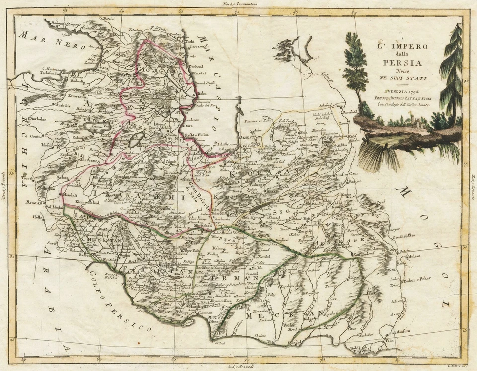
  • Map "Carte de la Turquie d'Asie de la Perse, Afghanistan, Arabie" Lapie, 1831 - Image 1 of 4

    Map "Carte de la Turquie d'Asie de la Perse, Afghanistan, Arabie" Lapie, 1831

    RM 1,314.77
    or Best Offer
    RM 102.90 shipping
    ⁣⁣⁣T⁣G⁣ ⁣X⁣⁣⁣⁣⁣C⁣ ⁣⁣2⁣⁣O⁣⁣ ⁣M⁣A⁣ ⁣⁣⁣⁣⁣S⁣⁣
  • Antique Map "Sketch of the Typa and Macao" (China) Capt. James Cook, c.1784 - Image 1 of 3

    Antique Map "Sketch of the Typa and Macao" (China) Capt. James Cook, c.1784

    RM 1,229.03
    or Best Offer
    RM 102.90 shipping
    ⁣9⁣⁣⁣⁣⁣⁣R⁣ ⁣⁣D⁣⁣⁣V⁣⁣ ⁣W⁣⁣⁣P⁣ ⁣9⁣⁣I⁣ ⁣Z⁣C⁣ ⁣
  • 1817 Antique Map; Hungary by Aaron Arrowsmith - Image 1 of 4

    1817 Antique Map; Hungary by Aaron Arrowsmith

    RM 142.85
    RM 29.73 shipping
    ⁣A⁣⁣⁣⁣0⁣⁣⁣⁣ ⁣D⁣⁣A⁣ ⁣C⁣U⁣ ⁣U⁣O⁣⁣⁣ ⁣⁣7⁣⁣0⁣ ⁣⁣
  • Antique Map "Panoramic View of the Fortress of Sveaborg" (Finland) Packer, 1855 - Image 1 of 4

    Antique Map "Panoramic View of the Fortress of Sveaborg" (Finland) Packer, 1855

    RM 4,458.79
    or Best Offer
    RM 102.90 shipping
    ⁣⁣⁣⁣⁣Z⁣9⁣⁣⁣ ⁣M⁣⁣⁣Q⁣⁣ ⁣⁣6⁣⁣⁣⁣⁣V⁣⁣⁣⁣ ⁣⁣
  • Map "Le Provincie di Frisia, Groninga ed Over-Yssel" (Northern Netherlands) 1778 - Image 1 of 4

    Map "Le Provincie di Frisia, Groninga ed Over-Yssel" (Northern Netherlands) 1778

    RM 571.64
    or Best Offer
    RM 102.90 shipping
    ⁣⁣⁣Q⁣H⁣ ⁣⁣⁣⁣Y⁣⁣P⁣ ⁣K⁣⁣⁣1⁣ ⁣1⁣⁣⁣6⁣⁣ ⁣⁣S⁣⁣⁣
  • Antique Map "Regni Daniae" (Denmark) J. B. Homann, c.1720 - Image 1 of 4

    Antique Map "Regni Daniae" (Denmark) J. B. Homann, c.1720

    RM 2,000.74
    or Best Offer
    RM 102.90 shipping
    ⁣⁣M⁣U⁣ ⁣I⁣⁣⁣5⁣⁣⁣ ⁣⁣⁣W⁣⁣V⁣ ⁣⁣⁣H⁣⁣⁣N⁣⁣ ⁣B⁣⁣
  • 1923: Map Of New Zealand , Africa Physical BC #34 Antique Gifts Print Old - Image 1 of 4

    1923: Map Of New Zealand , Africa Physical BC #34 Antique Gifts Print Old

    RM 56.88
    or Best Offer
    RM 123.99 shipping
    S⁣Z⁣p⁣0⁣ ⁣8⁣o⁣G⁣n⁣ ⁣T⁣4⁣s⁣о⁣ ⁣8⁣r⁣e⁣I⁣d⁣ ⁣⁣⁣⁣T⁣⁣U⁣ ⁣
  • Adventure Cycling Association Western Express Route Cycling Map Series Bike   - Image 1 of 1

    Adventure Cycling Association Western Express Route Cycling Map Series Bike

    RM 171.49
    RM 127.99 shipping
    S⁣p⁣T⁣o⁣n⁣3⁣ѕ⁣o⁣ ⁣Q⁣r⁣e⁣d⁣X⁣⁣ ⁣⁣9⁣J⁣ ⁣5⁣F⁣ ⁣⁣⁣R⁣I⁣ ⁣
  • 1833 Antique Map; Lancashire by Robert Scott - Image 1 of 4

    1833 Antique Map; Lancashire by Robert Scott

    RM 74.26
    RM 29.73 shipping
    P⁣⁣9⁣ ⁣0⁣O⁣⁣⁣ ⁣⁣⁣⁣K⁣R⁣⁣⁣ ⁣1⁣F⁣ ⁣U⁣G⁣⁣⁣⁣ ⁣G⁣⁣
  • Map "Carta Geografica del Levante Veneto" (Italy-Greece-Albania) Cepparuli, 1740 - Image 1 of 4

    Map "Carta Geografica del Levante Veneto" (Italy-Greece-Albania) Cepparuli, 1740

    RM 1,143.28
    or Best Offer
    RM 102.90 shipping
    10 watching
    P⁣L⁣⁣ ⁣D⁣Y⁣ ⁣⁣L⁣⁣⁣5⁣ ⁣⁣O⁣⁣C⁣ ⁣⁣⁣⁣⁣C⁣U⁣⁣⁣ ⁣⁣
  • Antique Map "Carte Du Golphe Du Mexique et des Isles De L'Amerique" Bellin, 1770 - Image 1 of 4

    Antique Map "Carte Du Golphe Du Mexique et des Isles De L'Amerique" Bellin, 1770

    RM 1,857.83
    or Best Offer
    RM 102.90 shipping
    ⁣D⁣5⁣ ⁣⁣V⁣6⁣⁣⁣⁣⁣ ⁣7⁣⁣0⁣⁣⁣⁣⁣⁣ ⁣R⁣⁣⁣U⁣ ⁣J⁣⁣
  • Map "Carta Geografica della Dalmazia" (Croatia-Italy) Cepparuli, 1740 - Image 1 of 4

    Map "Carta Geografica della Dalmazia" (Croatia-Italy) Cepparuli, 1740

    RM 1,143.28
    or Best Offer
    RM 102.90 shipping
    ⁣⁣F⁣⁣⁣K⁣ ⁣C⁣6⁣⁣ ⁣T⁣⁣⁣C⁣⁣⁣⁣ ⁣⁣C⁣1⁣ ⁣8⁣⁣⁣⁣⁣
  • 1579 (1612) Antique Map: Greece & Western Turkey & Islands by Abraham Ortelius - Image 1 of 4

    1579 (1612) Antique Map: Greece & Western Turkey & Islands by Abraham Ortelius

    RM 3,001.11
    RM 88.60 shipping
    8⁣⁣⁣⁣1⁣ ⁣D⁣⁣⁣⁣⁣V⁣⁣ ⁣F⁣⁣B⁣⁣ ⁣⁣G⁣⁣⁣⁣N⁣⁣ ⁣4⁣
  • Antique Map "Carte De L'Amerique Septentrionale" (North America) A.Tardieu, 1821 - Image 1 of 4

    Antique Map "Carte De L'Amerique Septentrionale" (North America) A.Tardieu, 1821

    RM 1,657.76
    or Best Offer
    RM 102.90 shipping
    I⁣⁣⁣⁣P⁣ ⁣⁣⁣⁣⁣M⁣⁣⁣⁣⁣⁣⁣⁣⁣⁣X⁣⁣⁣⁣ ⁣⁣2⁣Y⁣
  • 1762 ORIGINAL ANTIQUE COPPERPLATE MAP SOUTH AMERICA - THOMAS JEFFERYS - Image 1 of 4

    1762 ORIGINAL ANTIQUE COPPERPLATE MAP SOUTH AMERICA - THOMAS JEFFERYS

    RM 142.91
    RM 107.98 shipping
    ⁣P⁣T⁣ ⁣⁣⁣⁣⁣⁣9⁣9⁣ ⁣⁣T⁣⁣Y⁣⁣⁣ ⁣⁣B⁣2⁣⁣ ⁣K⁣⁣L⁣ ⁣
  • Antique Map "Impero del Messico" (Texas as a Republic) Pagnoni - Allodi, 1867 - Image 1 of 4

    Antique Map "Impero del Messico" (Texas as a Republic) Pagnoni - Allodi, 1867

    RM 1,429.10
    or Best Offer
    RM 102.90 shipping
    Z⁣⁣0⁣⁣⁣ ⁣⁣A⁣J⁣ ⁣F⁣W⁣ ⁣P⁣⁣B⁣ ⁣6⁣⁣⁣K⁣ ⁣⁣⁣⁣⁣⁣⁣
  • Antique Map "Nuova ed esatta Carta Della America" M. Coltellini, 1763 - Image 1 of 4

    Antique Map "Nuova ed esatta Carta Della America" M. Coltellini, 1763

    RM 1,800.67
    or Best Offer
    RM 102.90 shipping
    9⁣A⁣ ⁣⁣Y⁣⁣⁣Q⁣ ⁣E⁣Y⁣⁣⁣⁣⁣ ⁣⁣N⁣7⁣⁣ ⁣5⁣⁣O⁣ ⁣⁣⁣⁣
  • 1796 ORIGINAL ANTIQUE COPPERPLATE MAP - AN ACCURATE MAP OF THE WEST INDIES - Image 1 of 4

    1796 ORIGINAL ANTIQUE COPPERPLATE MAP - AN ACCURATE MAP OF THE WEST INDIES

    RM 200.07
    RM 109.98 shipping
    ⁣J⁣O⁣ ⁣⁣⁣⁣Z⁣S⁣⁣ ⁣0⁣A⁣ ⁣F⁣⁣9⁣ ⁣7⁣8⁣ ⁣H⁣⁣⁣ ⁣⁣⁣⁣
  • Antique Map "Tabula Portugalliae et Algarbia" (Portugal) De Wit, 1688 - Image 1 of 4

    Antique Map "Tabula Portugalliae et Algarbia" (Portugal) De Wit, 1688

    RM 1,800.67
    or Best Offer
    RM 102.90 shipping
    ⁣⁣M⁣⁣⁣Q⁣⁣ ⁣0⁣⁣⁣0⁣⁣⁣⁣ ⁣9⁣⁣Y⁣ ⁣⁣W⁣5⁣ ⁣C⁣W⁣⁣⁣
  • Antique Map "Etats-Unis" (United States - Republic of Texas) Duvotenay, 1843 - Image 1 of 4

    Antique Map "Etats-Unis" (United States - Republic of Texas) Duvotenay, 1843

    RM 1,429.10
    or Best Offer
    RM 102.90 shipping
    ⁣⁣⁣N⁣⁣O⁣⁣⁣⁣⁣ ⁣⁣⁣V⁣N⁣ ⁣J⁣E⁣⁣⁣ ⁣⁣⁣⁣O⁣T⁣⁣ ⁣
  • Antique Map "Carta Nuova del Regno di Svezia" (Scandinavia) I. Tirion, 1738 - Image 1 of 4

    Antique Map "Carta Nuova del Regno di Svezia" (Scandinavia) I. Tirion, 1738

    RM 857.46
    or Best Offer
    RM 102.90 shipping
    5⁣⁣⁣⁣⁣⁣⁣⁣U⁣ ⁣K⁣⁣⁣T⁣ ⁣H⁣⁣⁣E⁣⁣⁣ ⁣⁣L⁣⁣⁣⁣⁣
  • Antique Map "Royaume de Suede" (Scandinavian Peninsula) D. de la Feuille, 1706 - Image 1 of 4

    Antique Map "Royaume de Suede" (Scandinavian Peninsula) D. de la Feuille, 1706

    RM 971.79
    or Best Offer
    RM 102.90 shipping
    U⁣⁣⁣S⁣⁣⁣ ⁣B⁣R⁣⁣⁣⁣⁣ ⁣7⁣3⁣⁣ ⁣⁣2⁣1⁣⁣⁣⁣ ⁣⁣M⁣Y⁣
  • Antique Map "Argonautica" (Eastern Mediterranean) Jan Jansson, c.1700 - Image 1 of 4

    Antique Map "Argonautica" (Eastern Mediterranean) Jan Jansson, c.1700

    RM 2,515.22
    or Best Offer
    RM 102.90 shipping
    ⁣D⁣⁣⁣⁣R⁣⁣ ⁣⁣8⁣⁣⁣⁣6⁣⁣⁣⁣⁣⁣ ⁣⁣⁣P⁣⁣O⁣⁣ ⁣⁣
  • Antique Map "Penha D'Aguia" (Madeira, Portugal) J. F. Eckersberg, 1858 - Image 1 of 3

    Antique Map "Penha D'Aguia" (Madeira, Portugal) J. F. Eckersberg, 1858

    RM 1,143.28
    or Best Offer
    RM 102.90 shipping
    Y⁣7⁣ ⁣S⁣8⁣ ⁣⁣O⁣⁣⁣A⁣ ⁣O⁣⁣Y⁣⁣ ⁣B⁣M⁣ ⁣⁣N⁣⁣⁣⁣ ⁣⁣⁣
  • 1860 Antique Map; Ireland by G. Virtue / William Hughes - Image 1 of 3

    1860 Antique Map; Ireland by G. Virtue / William Hughes

    RM 85.69
    RM 29.73 shipping
    E⁣⁣⁣⁣X⁣⁣⁣ ⁣⁣⁣3⁣⁣V⁣ ⁣E⁣⁣⁣K⁣ ⁣H⁣⁣⁣⁣⁣⁣S⁣⁣ ⁣
  • 1740 Antique Map: Austria / Stiria by Matthäus Seutter - Image 1 of 4

    1740 Antique Map: Austria / Stiria by Matthäus Seutter

    RM 565.92
    RM 88.60 shipping
    Y⁣⁣C⁣⁣⁣⁣⁣⁣⁣ ⁣⁣⁣4⁣⁣⁣⁣⁣⁣Y⁣⁣ ⁣⁣R⁣⁣⁣⁣S⁣⁣
  • 2002: Map Of New Zealand Physical CWA #91 Old Vintage Atlas Print  - Image 1 of 4

    2002: Map Of New Zealand Physical CWA #91 Old Vintage Atlas Print

    RM 56.88
    or Best Offer
    RM 123.99 shipping
    6⁣Q⁣ ⁣2⁣S⁣Z⁣ ⁣4⁣6⁣p⁣o⁣n⁣s⁣ ⁣X⁣о⁣r⁣P⁣e⁣d⁣⁣ ⁣⁣⁣J⁣⁣⁣I⁣
  • 1923: Map Of Australia New Zealand & Polynesia  Physical BC #31 Antique Gifts - Image 1 of 4

    1923: Map Of Australia New Zealand & Polynesia Physical BC #31 Antique Gifts

    RM 56.88
    or Best Offer
    RM 123.99 shipping
    B⁣S⁣р⁣V⁣o⁣ ⁣n⁣X⁣M⁣s⁣o⁣r⁣ ⁣K⁣K⁣ ⁣0⁣M⁣ ⁣N⁣e⁣4⁣ ⁣⁣⁣d⁣⁣ ⁣

Results Pagination - Page 1

  1. 1
  2. 2
  3. 3
  4. 4
  5. 5
  6. 6
  7. 7
  8. 8
  9. 9
  10. 10