1950-1959 Date Range Antique World Folding Maps
51 Results
Original Map of River Thames Cirencester to Northmoor 1950 14" x 5.5"
RM 148.68RM 48.47 shippingColorprint New Era Map - The World No. 9577 Am Map Company 50" By 38" Reduced.
RM 118.50RM 252.03 shippingOriginal Map of River Thames Benson to Purley 1950 8.75" x 5"
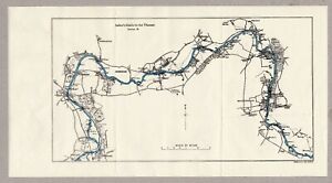
RM 148.68RM 48.47 shippingOriginal Map of River Thames Purley via Reading to Wargrave 1950 9" x 6"
RM 148.68RM 48.47 shipping1951 Political Wall MAP OF THE WORLD Printed in Color Decorative Border Railways
RM 94.75RM 89.06 shippingVintage Map 1959 Western Soviet Union
RM 56.50RM 131.73 shippingRussian Topographic Map Vietnam 7.3x10.2" Cold War Soviet Vintage 1958
RM 52.09RM 33.13 shippingLarge Folding Vintage Map of West Indies 1954
RM 56.50RM 131.73 shippingLands of the Eastern Mediterranean Vintage Map 1959
RM 56.50RM 131.73 shippingLarge Folding Vintage 1954 Map of Northern Africa
RM 56.50RM 131.73 shippingRussian Topographic Map Atlantic Ocean 7.3x10.2" Cold War Soviet Vintage 1958
RM 142.15Free postageVintage 1959 Canada Department Of Mines And Technical Surveys Map
RM 51.98RM 34.65 shippingKushiro Hokkaido Japan Kuril Islands USSR . USA Army Aviation Map 1954
RM 236.95RM 33.18 shippingOriginal Map of River Thames Wargrave via Maidenhead to Boveney 1950 10.5" x 6"
RM 148.68RM 48.47 shippingOriginal Map of River Thames Boveney via Windsor to Staines 1950 8.5" x 5"
RM 148.68RM 48.47 shippingOriginal Map of River Thames Northmoor to Oxford & Sandford 1950 7.25" x 5.25"
RM 148.68RM 48.47 shippingVINTAGE LOVELY CARTOON ILLUSTRATED MAP THE NILE EGYPT ALEXANDRIA TO ASWAN c.1950
RM 1,184.96RM 176.19 shippingVINTAGE 1955 NATIONAL GEOGRAPHIC MAP OF SOUTHEAST ASIA
RM 35.620 bidsEnding Saturday at 5:02AM MYT4dRM 94.50 shippingCanada Canadian Maps Ontario Quebec New Brunswick Nova Scotia Cranbrook c1950's
RM 469.84RM 178.42 shippingHuge Colorful 1958 Wall Map THE WORLD ON MERCATOR PROJECTION by Rand McNally
RM 90.01RM 89.06 shippingVtg 1953 The Geographical Institute /Bartholomew's Map of China Mongolia & Korea
RM 260.65RM 140.78 shippingOriginal Map of River Thames Nuneham & Abingdon to Benson 1950 8" x 6"
RM 148.68RM 48.47 shippingVINTAGE 1955 NATIONAL GEOGRAPHIC MAP OF THE ATLANTIC OCEAN
RM 35.620 bidsEnding Saturday at 5:03AM MYT4dRM 94.50 shippingVINTAGE 1955 NATIONAL GEOGRAPHIC MAP OF EASTERN SOUTH AMERICA
RM 35.620 bidsEnding Saturday at 5:03AM MYT4dRM 94.50 shippingVINTAGE 1951 NATIONAL GEOGRAPHIC MAP OF ASIA & ADJACENT AREAS
RM 35.620 bidsEnding Saturday at 5:03AM MYT4dRM 94.50 shipping1954 HAMMOND INTERNATIONAL MAP OF THE WORLD
RM 56.83RM 115.13 shippingVintage 1958 Rand McNally Map of the World 36" x 19.5" Rexall Druggist Mountable
RM 137.41RM 329.76 shippingOriginal Map of River Thames Staines to Hampton Wick 1950 9.25" x 5"
RM 89.21RM 48.47 shippingVINTAGE June 1951 NATIONAL GEOGRAPHIC MAP OF THE UNITED STATES OF AMERICA
RM 142.15RM 126.32 shippingVintage National Geographic Magazine Lands of the Bible Today Map 1956
RM 165.85RM 124.57 shipping1958 Universal Map of the World Imperfect Color Book Enterprises Large
RM 94.56RM 130.97 shippingVintage 1958 July 31, British Isles Map By National Geographic Society One-Sided
RM 47.35RM 133.38 shippingTurkey Greece Syria map Vintage 1950 Collier's Encyclopedia / Rand McNally
RM 66.08RM 165.85 shippingVintage 1958 July 31, British Isles Map By National Geographic Society One-Sided
RM 47.40RM 109.83 shipping1957-1958, 34" X 44" Scholastic Magazines’ News Map, Fold Out World map
RM 47.40RM 117.60 shippingENORMOUS Universal Map of the World Book Enterprises 1958 Edition
RM 28.39RM 105.42 shippingVintage Nan Hua Publishing Co. - Map of America - Map 30x22”
RM 71.10RM 228.47 shipping1957, Moscow schematic plan mid. size 39x44 cm. Москва план схема.
RM 69.13RM 114.35 shippingVINTAGE 1954 NATIONAL GEOGRAPHIC MAP OF THE WEST INDIES
RM 41.57RM 115.14 shippingVINTAGE 1953 NATIONAL GEOGRAPHIC MAP THE GREAT LAKES REGION U.S.A. AND CANADA
RM 23.73RM 114.54 shippingVINTAGE 1954 NATIONAL GEOGRAPHIC MAP OF NORTHERN EUROPE
RM 35.62RM 114.96 shippingVINTAGE 1950 NATIONAL GEOGRAPHIC MAP OF NORTHWESTERN UNITED STATES OF AMERICA
RM 23.73RM 114.54 shippingVINTAGE 1955 NATIONAL GEOGRAPHIC MAP OF EASTERN SOUTH AMERICA
RM 41.57RM 115.14 shippingVINTAGE 1956 NATIONAL GEOGRAPHIC MAP OF ROUND & ABOUT THE NATIONS CAPITAL
RM 23.73RM 114.54 shipping1958-1959, 34" X 44" Scholastic Magazines’ News Map, Fold Out World map
RM 56.83RM 109.73 shippingOrdnance Survey Sheet NY30 1:25000 Ambleside 1959
RM 5.950 bidsEnding May 13 at 12:58AM MYT5d 20hRM 96.11 shippingNATIONAL GEOGRAPHIC MAP- NORTH CENTRAL USA -1958
RM 20.82RM 98.43 shippingNational Geographic Map: Western Soviet Union, 1959
RM 35.68RM 125.96 shippingWorld And European Map Of Airmail Routes 23th edition Berne 1950
RM 352.16RM 102.08 shipping1958 ESSO WORLD NEWS MAP "KNOW YOUR WORLD" MAP GIFT FROM OCTOBER
RM 39.11RM 95.04 shipping1958 Universal Map of the WORLD Opens up to a Full Huge Page!
RM 34.08Was: RM 42.61RM 114.99 shipping